Churchillplein and the Westblaak
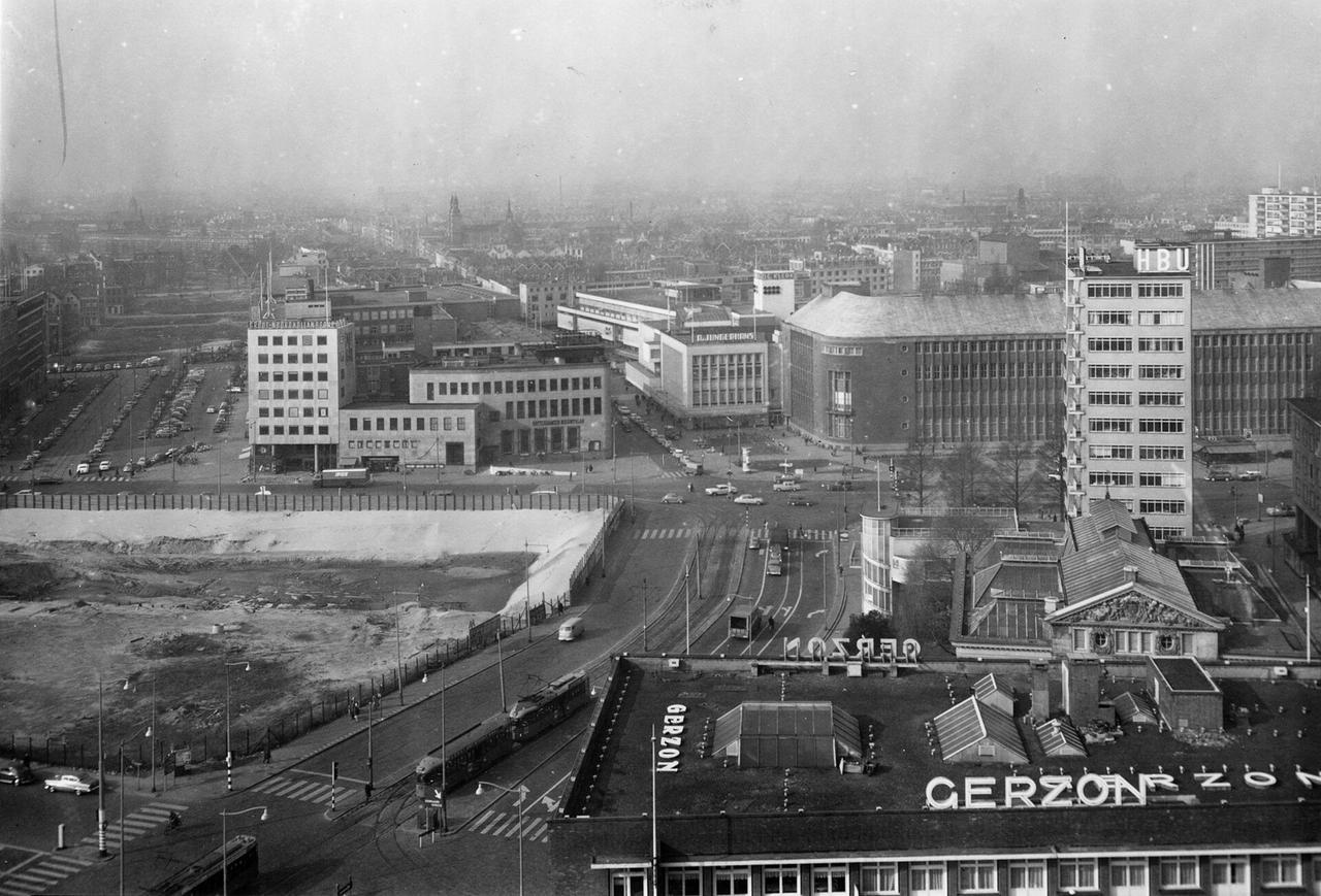
Where you're standing now there used to be water, because the Blaak was a harbour, filled in during the nineteenth century when shipping moved west, and the postwar Basisplan, the master plan that guided Rotterdam's reconstruction, turned that strip into a boulevard well over sixty metres wide. That width comes straight out of the plan: Van Traa, the city architect behind it, counted on a city full of cars, and the Westblaak was drawn for a traffic load that never quite arrived.
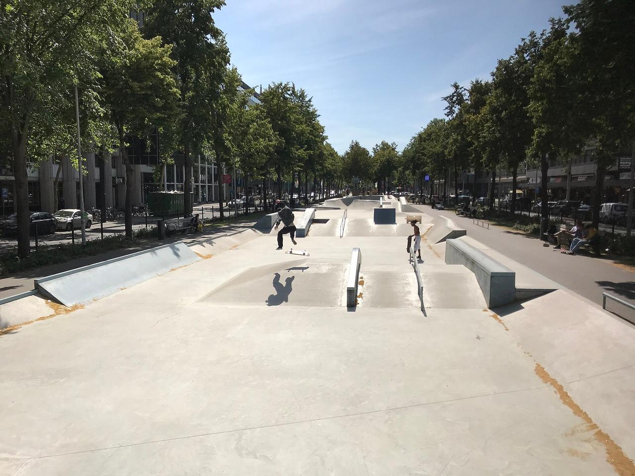
You can see what came of that down the middle of the boulevard. On the broad central strip there's been a skatepark since the start of this century, one of the largest in the country, and what began as leftover space is now where Rotterdam lives out its free time.
The square itself carries the name of Winston Churchill and sits at the meeting point of the two axes that shaped the plan, the Coolsingel running north to south and the Blaak running east to west. Everything here was built after 1945, and the office towers around it show in their height which decade put them up.
We follow the Westblaak eastward, a solid stretch of nearly a kilometre, until the water of the city's oldest harbour appears on your right.
Any feedback for this story?